
Public Rights of Way
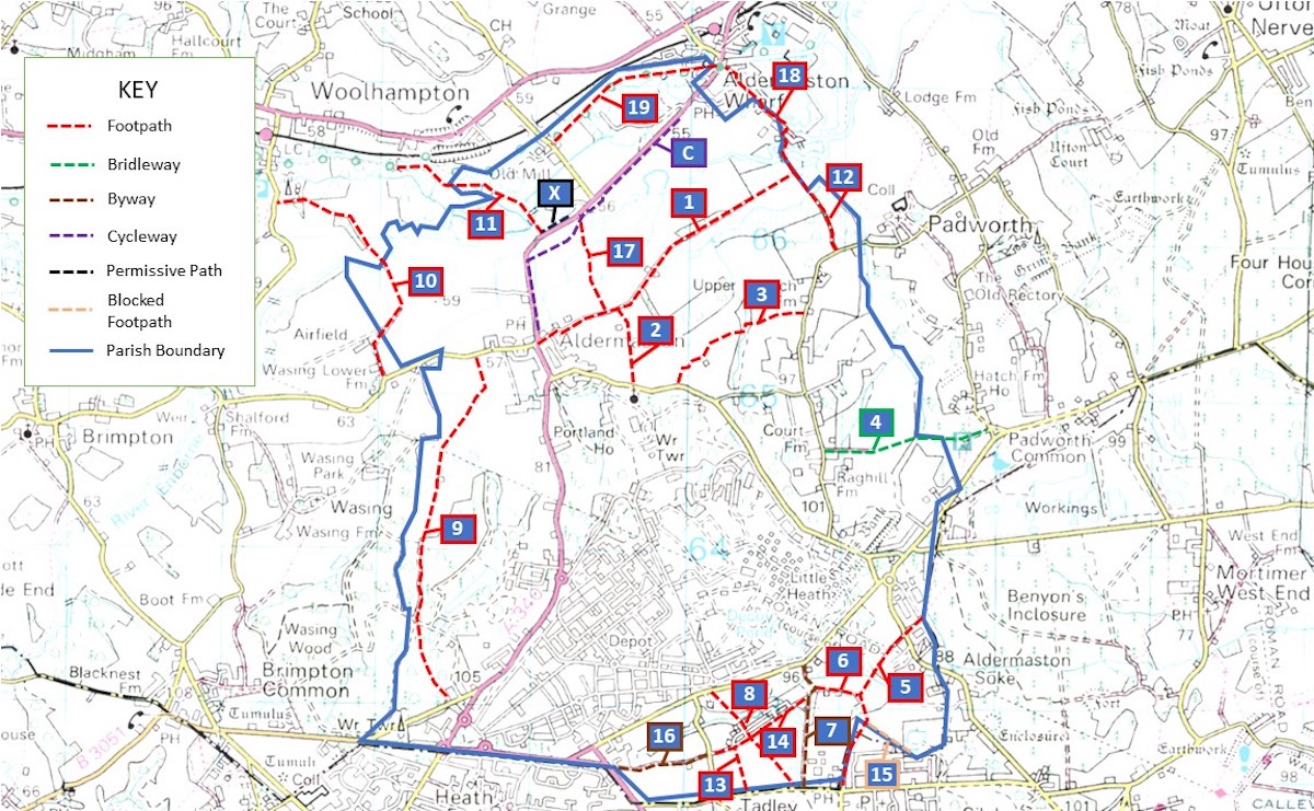
Map of Aldermaston Footpaths and Public Rights of Way
We are lucky to have a number of Public Rights of Way (PROWs) in our Parish. The map below shows where these are.
footpaths - for walking, running, mobility scooters or powered wheelchairs
bridleways - for walking, horse riding, bicycles, mobility scooters or powered wheelchairs
restricted byways - for any transport without a motor and mobility scooters or powered wheelchairs
byways open to all traffic - for any kind of transport, including cars (but they’re mainly used by walkers, cyclists and horse riders)
If there is a problem with any of the PROWs please report to West Berkshire Council using this link.
A note on footpath naming conventions. The PROW descriptions on the Aldermaston Parish Map use a simplified naming convention derived from the West Berkshire Definitive Map numbering system i.e. the Parish name followed by the path number e.g. ALDE /1/x on the definitive map is referred to as “1” on the Aldermaston Parish map.
Footpath 1 - Approx distance 1mile
This path begins by the Aldermaston Store in the village, following the track known as Fisherman’s Lane. After a short distance it passes Footpath No17 to the left and then Footpath No2 on the right. The path continues through grazing meadowland to the Parish boundary where it joins Footpaths No18 to the left and No12 to the right.
Footpath 11 - Approx distance 0.90mile
Though this footpath stems from Woolhampton it follows the River Kennet along some very lovely countryside and enters our Parish at a point just before the Kennet River and Canal part company. Continue past the entrance to the Marina and towards The Old Mill at which point it turns away from the river and toward the A340 and ALDE /17/1.